NOWCAST THROUGH LATE MORNING:
Clear and cooler.
6am: Clear 44°
8am: Clear 48°
10am: Sunny 55°
COOLER BUT NICE:
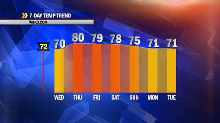
A cold front swept through our region sending winds around to the northwest and bringing slightly cooler temperatures in for midweek. We’ll start with readings in the lower 40s. Under lots of sunshine, today’s highs should top out in the upper 60s to near 70° – just a bit below normal for late April. Things stay quiet through most of Thursday with a breezy south wind taking us back up to near 80 Thursday afternoon.
ANOTHER SHOT FOR SHOWERS:
Our next system arrives Thursday night with a good chance for showers and thunderstorms. Rain ends by early Friday morning, with sunshine returning to close out the work week. Highs remain close to 80 Friday.
THE WEEKEND:
Seasonable temperatures are expected Saturday into Sunday, with a chance for rain to close out the weekend. Things stay unsettled early next week, as a stalled front will cause several rounds of rain and thunderstorms which could lead to some minor flooding.
——
TODAY:
Sunny and Pleasant…High 68, winds NE-5
TONIGHT:
Mainly Clear and Mild…Low 46, winds Calm
THURSDAY:
Partly Sunny, Breezy and Warm…High 80, winds S-13
